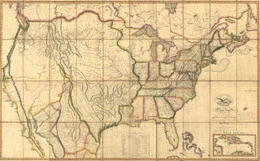
Five historical American map collections, free and online, with thousands of maps of the U.S. Some sites also have collections for the rest of the world.

1. Historical Atlases and Maps of U.S. and States
For each state, this site provides a variety of vintage maps and atlases, an interactive map showing the evolution of county boundaries, and links to other collections of historical maps for the state. Also see the links to nationwide historical atlases.
2. 3,500 Historic Maps at John Carter Brown Library
This collection at Brown University, Rhode Island, has images of maps from around the world from as early as 1482.
3. 400 years in Illinois and the Old Northwest
Images of maps charting the last 400 years of historical development in Illinois and the Northwest Territory, including historic topographic maps of Illinois. The collection at University of Illinois Libraries also contains early large-scale topographic quadrangles published by the United States Geological Survey in the late nineteenth and early twentieth centuries.
See our Britannica Encyclopedia pdf
4. Maps of Louisiana Territory: European Explorations and the Louisiana Purchase
At the Library of Congress. “This presentation focuses on the various documents from maps to newspapers to cultural artifact that help to describe the region of North America that stretched from as far east as Alabama into what is now the state of Montana. The 119 items presented here come from the various special and general collections of the Library of Congress.” – LOC introduction.
5. Historical Maps of the U.S. from the Perry-Castaneda Library
At the University of Texas. Contains a large collection of historic maps of the U.S., with emphasis on Texas and the American west. There are also other graphical representations of geographic, historic and demographic data, and modern and historic maps for most of the world.
See our Century Past Resources collection, containing more free online map collections as well as hundreds of history articles.
