
Historical Illinois maps, vintage atlases and gazetteers for Illinois and Chicago. Includes collections. All free online.
Table of contents
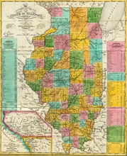
Historical Illinois Maps – Collections
Counties of Illinois: their Origin and Evolution, with Twenty-three Maps Showing the Original and the Present Boundary Lines of each County of the State
Hughes, Edward J., comp.
Springfield: State of Illinois 1941
Map of Illinois counties.
Railroad Maps of Illinois
Illinois Digital Archives
Various publishers and years of publication
39 State-wide maps of Illinois’ rail transportation network, published from the late 19th through the late 20th centuries.
Railroad Maps of Illinois 1828-1900
LOC Geography and Map Division
Various Publishers
Eleven 19th century railway maps of Illinois.
Illinois Historical Maps and Atlases
Historic MapWorks
According to the Historic MapWorks website, the State of Illinois collection contains 3,149 atlases spanning the years 1696-2007. Within the atlases are 191,165 historical maps, illustrations and histories.
Historical Maps Online
University Library, University of Illinois at Urbana-Champaign and University of Illinois Press
The intent of the Historical Maps Online project is to electronically publish the images of maps charting the last 400 years of historical development in Illinois and the Northwest Territory.
Old Maps Online
This is a collaborative portal for accessing a number of online map collections worldwide. U.S. collections include;
The David Rumsey Collection
Harvard Library Collection
New York Public Library Collection
Leventhal Map Center at Boston Public Library
North Carolina Digital Heritage Center.
60 Panoramic maps or Birds-eye views of various Illinois cities and towns
Library of Congress
Various publishers and years of publication
Many of these are highly detailed pictures showing all buildings. The viewer at this site enables high-resolution zooms.
Federal Township Plats of Illinois (1804-1891)
Illinois State Archives
The Illinois State Archives digitized its 3,457 federal township plats of Illinois. These are hand drawn plats that show Illinois’ landscape as it was before American settlement as well as legal surveying measurements. Occasionally the plats indicate man-made features, both Indian and European. The U.S. Surveyor General and his deputy surveyors drew these maps of “six miles square” townships or fractional townships in preparation for the Federal government’s sale of public lands.
LOC Atlases and Maps of Illinois
LOC Geography and Map Division
Various Publishers
70 Library of Congress Atlases and Maps for Illinois. Most show landowners in Illinois counties.
Sanborn Maps at Library of Congress – Illinois
The Sanborn maps are extremely detailed maps of cities and villages produced by the Sanborn Company for use by fire insurance agents in the late 19th and early 20th centuries. The maps are at a scale of 50-feet to one-inch. Some of the maps for the largest cities in the U.S. were over 100 pages. Maps show individual buildings, the construction materials used, and the purpose of the building. Sometimes the company name is included for business buildings.
This Library of Congress free online collection has over 35,000 online Sanborn maps for thousands of U.S. cities and villages. Many towns have more than one map produced over several decades. When searching for a town in Advanced Search, choose a state first to see the complete list of cities in that state. See “About this Collection” (at the Sanborn page) for a full explanation of the symbols and conventions used in the maps.
Topographic Maps – Illinois
Illinois Library
Various Publishers
About 80 topographic maps of many areas of Illinois, published throughout the 20th century.
Historical Individual Illinois and Chicago Maps – Old Illinois Atlases
See our Century Past collected links to free online map sites. We have 5 pages of links: for the U.S., North America, UK & Ireland, Worldwide, & Military maps.
Parts of Missouri, Illinois and Indiana 1833
Rumsey
Great Britain: Society for the Diffusion of Useful Knowledge 1833
The Tourist’s Pocket Map of Illinois, exhibiting its internal improvements, roads, distances &c 1834
University of Illinois at Urbana-Champaign
Philadelphia: Mitchell 1834
This also includes a list of steamboat routes, and an inset map of the “Lead Mine Region East of the Mississippi River”.
Map of a Portion of the Indian Country [in the later states of Wisconsin and Illinois] 1835
University of Illinois at Urbana-Champaign
Gales and Seaton 1835
“A map of a portion of the Indian country lying east and west of the Mississippi River to the forty sixth degree of north latitude from personal observation made in the autumn of 1835 and recent authentic documents.”
See our free books on Illinois economic topics
A New Map of Illinois with its Proposed Canals, Roads & Distances from Place to Place along the State & Steam Boat Routes 1836
Lewis University
Philadelphia: Tanner. 1836
Mitchell’s Map of Illinois Exhibiting its Internal Improvements, Counties, Towns, Roads 1837
Lewis University
Mitchell 1837
Map of Illinois counties.
Blanchard’s Township Map of Illinois 1869
University of Illinois at Urbana-Champaign
Chicago: R. Blanchard 1869
“Showing all the rail roads, stations, and towns, being a complete shippers guide to the state with parts of Iowa and Missouri.”
Illinois 1894
University of Illinois at Urbana-Champaign
Chicago: Cram 1894
Shows railroad lines statewide.
Landforms of Illinois 1956
University of Illinois at Urbana-Champaign
James A. Bier 1956
Topographical map of the state, including towns.
See our free Illinois history books & articles
City of Chicago 1853
Harvard University
Cook Co., Illinois. Henry Hart. 1853
Extremely detailed, this appears to show every building.
Chicago 1857
Library of Congress
Chicago: Braunhold & Sonne, 1857
Click “Go” under the image window to make it download. This “Birds eye” view Illinois historical map was not drawn to scale. It portrays the buildings in the city in fine detail, with a key at the bottom identifying important buildings.
Birds eye view of the Chicago packing houses & union stock yards 1890
Collection
Chicago: Charles Rascher 1890
Detailed drawing showing all the buildings and other areas in the Chicago stockyards in 1890. Many of the buildings are identified by their function and the company that operated there.
Bird’s eye view of the World’s Columbian Exposition, Chicago, 1893
Library of Congress
Rand McNally 1893
A detailed drawing providing an excellent view of all the buildings of the exposition.
A Map of Chicago’s Gangland from Authentic Sources 1931
University of Illinois at Urbana-Champaign
Chicago: Bruce-Roberts 1931
This historical Illinois map was … “Designed to inculcate the most important principles of piety and virtue in young persons, and graphically portray the evils and sin of large cities.”
Metropolitan Chicago and Vicinity 1956
Rumsey Map Collection
Chicago: Shell Oil Company 1956
Originally published as a roadmap for distribution at Shell service stations.
Springfield, Illinois 1867
Library of Congress
Chicago Lithographing 1867
“Birds eye” view of his historical map was not drawn to scale. It shows all the buildings in the city and street names, with a key at the bottom identifying important buildings.
See our Illinois historic documents
Indian Land Cessions in Illinois. Illinois Map 1
Indian Land Cessions in Illinois. Illinois Map 2
18th Annual report of the Bureau of American Ethnology: Schedule of Treaties and Acts of Congress
Smithsonian Institution: Bureau of American Ethnology
GPO 1896-97
The 18th Annual report of the Bureau of American Ethnology contains, in the latter portion of Volume 2, a “Schedule of Treaties and Acts of Congress Authorizing Allotments of Land in Severalty”. Included in this is a “Schedule of Indian Land Sessions” that provides summary descriptions of each case throughout the U.S. in which a tribe ceded land (whether by sale or not) to the U.S. Federal government. The Schedule is followed by maps of every U.S. state that contained such land cessions. These maps show the locations of land ceded. A number on each land cession corresponds to an entry in the “Schedule of Indian Land Sessions”, which begins on page 648 of the Annual Report.
How to use this: Click the link for Illinois Map 1, which is at images 552-553 of the Report, or Map 2, at 556-557. Note the number of the land cession you wish to read about, and search for that number in the Schedule (3rd link above) that begins on page 648 of the Annual Report. This Schedule is organized as a table that spans 2 pages, so look on odd-numbered pages for the land cession number that corresponds with the map location. The preceding page contains a description for that cession, plus a reference to the legal statute.
Interactive Map of Illinois County Formation History
Map of US.org
Scroll part-way down this webpage for the interactive online map, which shows the changing county borders over time, from 1790 to 1869. You can also see the county boundaries in each census year from 1810 to 1930. Map of Illinois counties.
Old Illinois Gazetteers
A Gazetteer of the States of Illinois and Missouri, containing a general view of their counties, and a particular description of their towns, villages, rivers, &c: with a map, and other engravings
Beck, Lewis C.
Albany: Webster. 1823
Illinois historic gazetteers.
Profiles of Illinois: History, statistics, demographics for 1,436 populated places in Illinois including comparative statistics and rankings
Garoogian, David
Grey House 2011
“This edition provides data on all populated communities and counties in the state of Illinois for which the US Census provides individual statistics. It includes seven major sections that cover everything from Education to Ethnic Backgrounds to Climate. All sections include Comparative Statistics or Rankings, and full-color Maps at the back of the book provide valuable information in a quickly processed, visual format.” – Introduction
Gazetteer of Illinois, in Three Parts …
containing a general view of the State, a general view of each county, and a particular description of each town, settlement, stream, prairie, bottom, bluff, etc.; alphabetically arranged
Peck, John Mason
Philadelphia: Grigg & Elliot 1837
Rand, McNally & Co.’s Bird’s-eye Views and Guide to Chicago
Indispensable to every visitor. Containing innumerable details of business and residence localities; the most charming drives, the various means of transportation, including routes t the exposition, depots, etc.; together with a complete directory of churches, clubs, hotels, cafes’ theaters, amusements, public buildings, parks, and monuments- a graphic description, in short, of every object of any interest in the city. Historical Illinois Maps.
Rand, McNally
Chicago: Rand, McNally 1893
Related Resources on Century Past
See our Century Past directories for hundreds of webpages of Great Lakes States Resources; Magazines; Books; Articles, Maps & Photos; & Newspapers. You’ll find the same directories on the top Menu. Here are a few suggested pages: